In this video civilians on some kind of aviation adventure discover and report what turned out to be the Washington Fire southeast of Lake Tahoe near Markleeville, California. They reported it on June 19, 2015 and by June 23 the fire had burned over 16,000 acres.
The map below shows heat from the fire detected by a satellite on June 21, 2015.
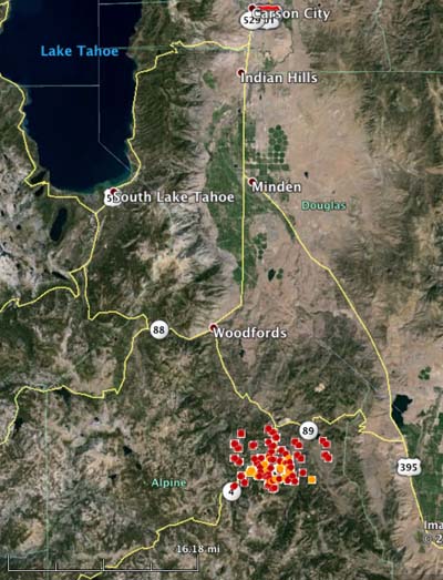
More information about the Washington Fire.
Thanks and a tip of the hat go out to David.
Until there is a policy of initial attack by the Feds to at least attempt to contain these fires within the first burning period, the Forest Service will continue to be the “Big Box” resource agency. The closest Fed air tanker base was at Minden closed for over a decade. Maybe the jet era of air tankers will take up the slack. In this part of California, although in R 5, the dispatching is more like R 4, wait and see who can loan us an air tanker.