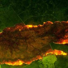
Above: An example of a fire map produced by the Air Affairs infrared mapping system.
A company with an unusual name, “Air Affairs”, has been mapping wildfires (or bush fires) in Australia since 1994. Not unlike the systems the U.S. Forest Service has been using since at least the 1970s, Air Affairs uses infrared line scanners to detect heat produced by the fires, even if they are apparently obscured by smoke.
That heat is then plotted on a georectified map and transmitted via a satellite link directly from the aircraft in a format compatible with Geographic Information Systems (GIS) used by the state fire authorities. The image data requires no further processing by fire personnel and is available for immediate use.
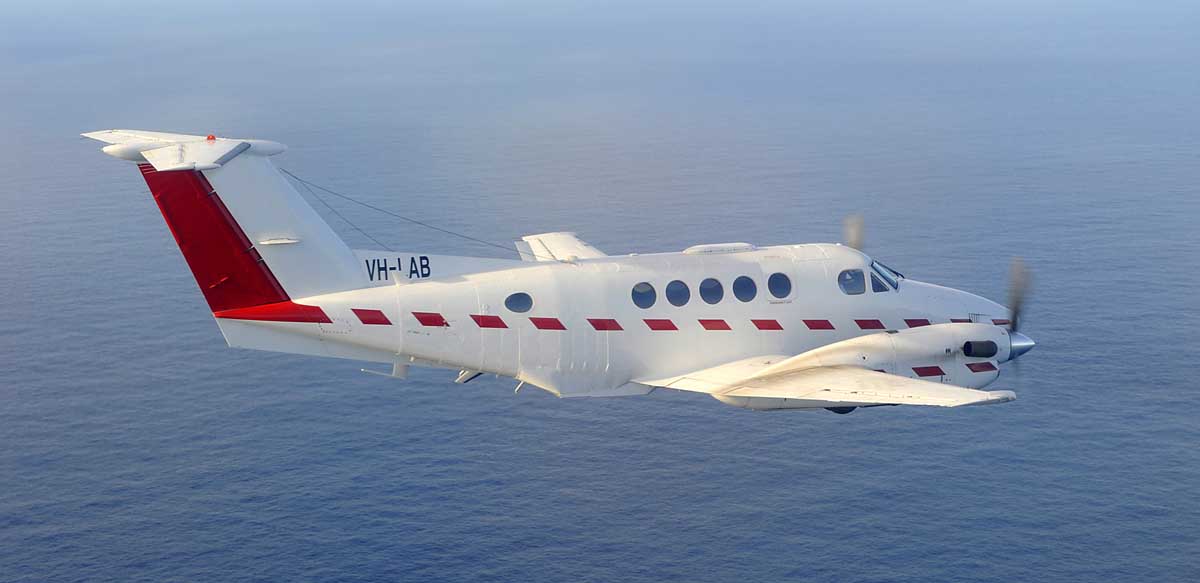
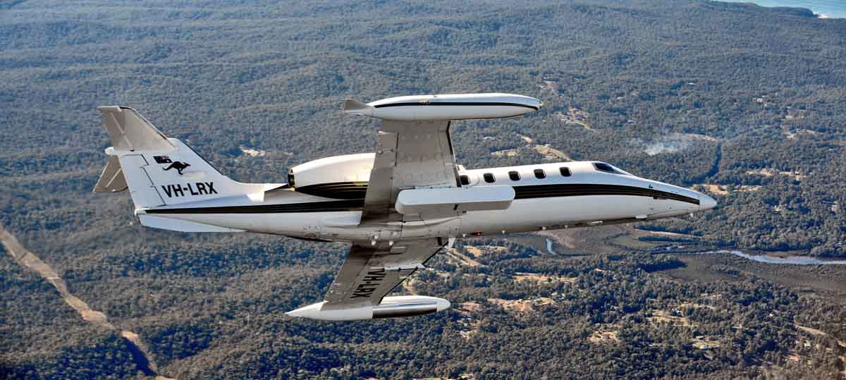
Air Affairs has two line scanners. One is permanently mounted in the belly of a Beechcraft B200T. The other is a pod which can be attached to one of the company’s Learjets.
Interestingly, the USFS has two similar aircraft with line scanners — a Citation jet and a King Air.