The crew will provide intelligence on emerging and existing large fires in central Alaska
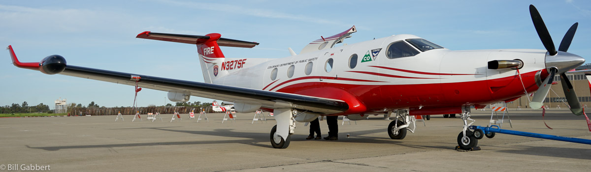
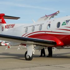
File photo of one of Colorado’s two Pilatus PC-12 “Multi-mission Aircraft” at Sacramento McClellan Airport March 23, 2016. Photo by Bill Gabbert.
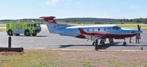
One of Colorado’s two Multi-mission Pilatus PC-12 aircraft is being dispatched to Alaska to assist with the wildfires burning in the state. The other will remain in Colorado and continue supporting fires and other incidents there.
The PC-12 will depart Centennial today, July 2, to be based out of Fairbanks, Alaska. The crew consists of two sensor operators, a pilot, and a mechanic. The team will support initial attack firefighters and provide intelligence on emerging and existing large fires in central Alaska.
Meanwhile the other PC-12 in Colorado is on fire detection missions today in Jefferson County, Douglas County, and the Arapaho-Roosevelt National Forest.
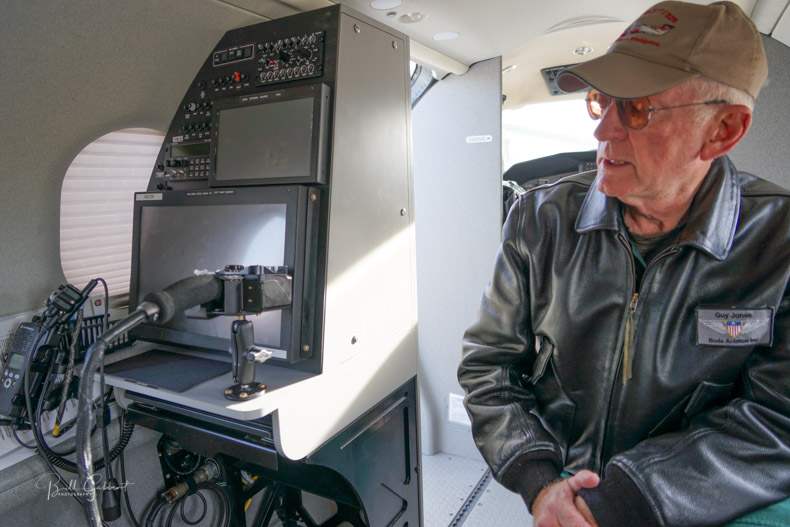
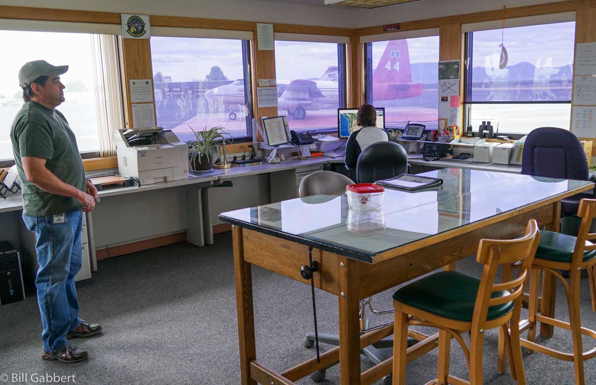
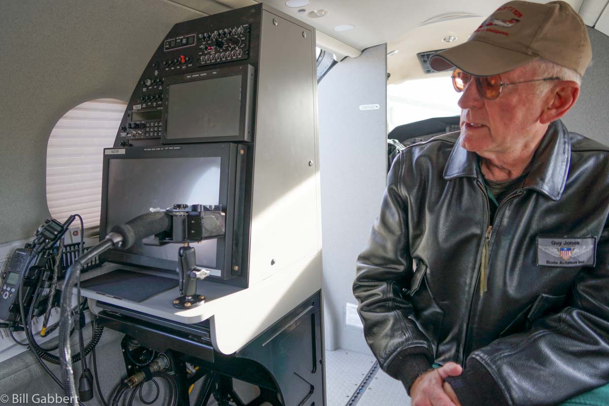
Guy Jones describes the intelligence console on Colorado’s PC-12 Multi-Mission Aircraft, at Sacramento McClellan Airport, March 23, 2016.
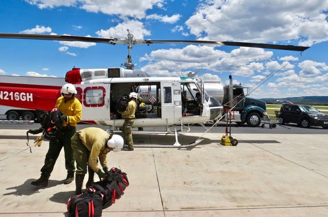
The Durango Helitack crew demonstrates crew loading.
Rick Freimuth sent us these photos and description of a Safety Fly-In that occurred Friday, May 31 at the Durango Air Tanker Base in Colorado. Mr. Freimuth staffs the Benchmark Lookout west of Telluride, Colorado where he normally would have been, starting three weeks ago, but snow on the roads has made that impossible. The tower is at 9,262′ elevation.
Yesterday I attended the San Juan National Forest Safety Fly-In event at the Durango Airtanker Base. It’s an annual event (except last year because of our busy fire season) held for the local jurisdictions – USFS, BLM, NPS, Durango Fire & Rescue and other local towns and counties. The Fly-In is designed to familiarize the firefighters with air-to-ground radio protocol, general aircraft safety, crew loading, hard landings (turning off fuel, electrical and rotor brakes).
Durango Helitack was represented with their Bell 205, pilot, crew manager and crew. They demonstrated sling load loading and hookups, bucket hookups and crew loading. To increase performance for their older ship the 205 is hopped up with wider composite rotor blades, fins along the tail boom and the tail rotor is repositioned on the right side instead of the traditional 205 left side. Interesting. Of course Durango Helitack’s primary mission is IA but they also perform bucket work and rescues with the ability to carry two patients.
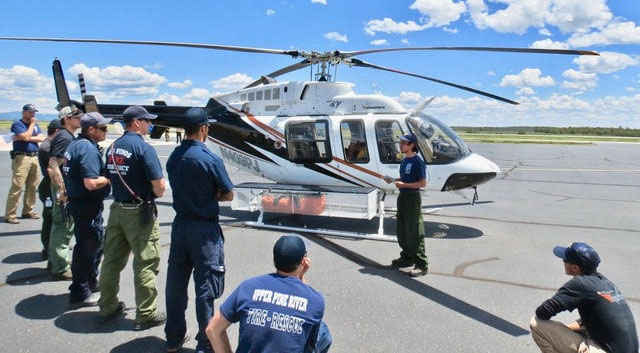
Mesa Verde National Park Helitack crew member describes National Park Service aviation protocol.
Mesa Verde NP Helitack was there with their Bell 407. They gave us a great demonstration of capabilities from their crew manager and one of their IA firefighters. Their primary mission is IA but are also equipped for bucket work and they are the only Short Haul capable crew in the Four Corners area. They’re capable of in-cabin litter transport as well.
Flight For Life’s orange A-Star 350 based at Durango’s Mercy Regional Medical Center was there with pilot, flight nurse and paramedic. They talked about their protocol as well as their A-Star’s excellent capabilities at high altitude rescue in the local San Juan mountain ranges. They gave an excellent demonstration of patient loading with firefighters assisting.
An interesting addition to the Fly-In was a Bell 206 from the Durango & Silverton Narrow Gauge Railroad excursion train. Simply referred to as the train helicopter. It’s mission is to follow the train up and down the route for fire suppression in case the coal burning engines ignite fuels in their right-of-way. They carry a 75 gallon bucket filled 3/4 full for several hours a day looking for smoke. The reason for the reduced fill is to increase fuel efficiency during the day at high altitudes.
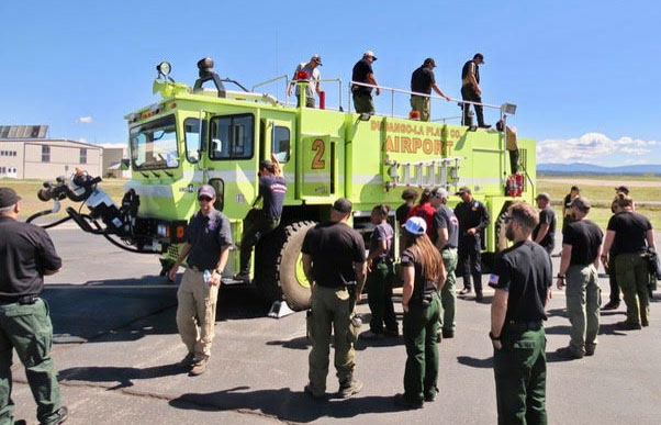
Durango airport’s Oshkosh crash rescue truck.
The Durango-LaPlata County airport showcased one of their two, huge Oshkosh fire engines including a thorough discussion of the airport firefighters duties and responsibilities for the myriad aircraft that may land at the field in emergency situations.
The most interesting aircraft, for me, was the State of Colorado’s Multi Mission Aircraft (MMA). The Colorado Division of Fire Prevention and Control has two Pilatus PC-12 airplanes that have been outfitted with state-of-the-art fire detection infrared (IR) and color sensors (EO) operated by sensor operators from the Division of Fire Prevention and Control Wildland Fire Management staff. The pilot, Carl Gordon and sensor operator, Jesse, gave us a complete description of their real-time fire mapping capabilities. Jesse said they were able to send their maps to the ICs and firefighters within twenty minutes of flying the fire. The firefighters are then able to access the up-to-date fire maps on Avenza.
The retardant base was an interesting station at the Fly-In. We were given a thorough explanation of mixing Phos-Chek with water to create the loads appropriate to fuels and elevation. Durango Airtanker Base is the highest elevation tanker base at 6,685′. The retardant loads have to be altered to the summertime temperatures, high elevation of the airport and the, possibly, higher elevations of the fires. Durango Airtanker Base’s retardant base is now able to fill two air tankers at a time.
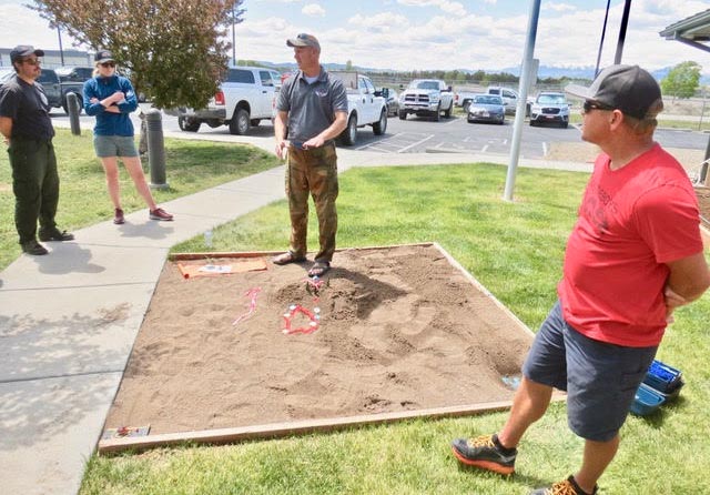
Jerran Flinders (center, wearing sandals) uses a sand “table” to explain air attack strategy, with Mike Bryson, on the right.
The last station at our Fly-In event was the sand table (sand box in our case). Jerran Flinders, the San Juan National Forest’s Aviation Officer and Mike Bryson, the Durango Airtanker Base Manager gave the attending firefighters scenarios of making a resource order for air tankers or helicopters on an active fire. The sand box had a fire climbing a slope through timber and approaching a ridge-top structure. Jerran lead the scenarios through requesting aircraft, communicating with air attack and delivering the retardant load. This was an excellent demonstration, for green firefighters, of what to do and what not to do during a wildfire event.
The Safety Fly-In was attended by roughly one hundred fire staff including firefighters, fire overhead, and one lookout.
The state of Colorado is working on a system that would use drones to provide live video of wildfires to wildland firefighters’ cell phones. The Center of Excellence for Advanced Technology Aerial Firefighting is beta testing a DVI Mavic drone that would push the real time video to firefighters using software developed by the military, Android Team Awareness Kit (ATAK).
The program has the capability of displaying data from tracking devices carried by soldiers, or firefighters, and identifying their location on a map, which in this case could also show the fire in real time.
If they are successful in developing and implementing a system that can provide to fire managers real time information about the location of a wildfire AND firefighting resources, it would achieve what we call the Holy Grail of Wildland Firefighter Safety — knowing those two elements of information.
The DJI Mavic can only stay in the air for 20 to 30 minutes before having to return to base to replace the battery. So this beta test is probably only a proof of concept attempt, perhaps leading to a more robust drone, rotor or fixed wing, that could stay in the air for a much longer period of time.
One of the two State of Colorado’s Pilatus PC12’s, was photographed in March of 2016 in Sacramento.
Colorado already has the ability to transmit near real time imagery of fires from their two MultiMission Aircraft, Pilatus PC12’s. They are integrated with the Colorado Wildfire Information System, a geospatial database that displays incident images and details to local fire managers through a web based application.
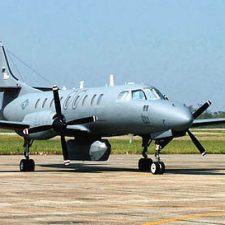
An RC-26 from Fairchild Air Force Base in Spokane is assisting with situational awareness in the firefighting effort.
Above: An example of an RC-26, in this case a Texas Air National Guard aircraft. ANG photo.
(Originally published at 1:52 p.m. MDT August 16, 2017)
A military plane frequently used for supporting Special Forces is assisting wildland firefighters in Washington and Oregon. The Fairchild C-26 “Metroliner” twin turboprop from the 141st Air Refueling Wing was activated by the National Interagency Coordination Center on August 12 to perform up to three different types of missions using its array of infrared and video sensors.
Detect new fires, especially following lightning events. One of the goals is to find small fires early so they can be attacked before growing large.
Map existing fires, usually at night, to determine the perimeter and intensity.
Downlink live video to inform fire managers about the current status, location, and behavior of the fire. The Air Force calls that process “DRTI”, Distributed Real-Time Infrared.
Lt. Col. Jeremy Higgens, one of the pilots on the aircraft that requires a three-person crew, told us today that so far on this assignment they have been mapping and detecting fires, but have not yet been asked to stream any live video like they did when on a similar assignment in 2016. On the ground two displays are available, the video from the sensors and another with a map showing the location of the aircraft or the sensors’ target.
The plane is expected to work the fires seven days a week, so they brought a total of five people to provide daily service.
Lt. Col. Higgens said the infrared sensors can detect a fire that is 50 to 80 miles away. They have been flying one to two sorties a day each lasting for three to five hours. Their mapping data is sent to Geographic Information System (GIS) operators in Portland or Boise who analyze it and produce maps.
Colorado’s Pilatus PC-12 “Multi-mission Aircraft” at McClellan Air Field March 23, 2016. Photo by Bill Gabbert.
Two State of Colorado Pilatus PC-12 Multi-Mission Aircraft with similar capabilities were also mobilized earlier this summer to assist with wildfire detection and mapping and are currently operating from Redding, California and Missoula, Montana.
A couple of decades ago the U.S. Forest Service had a variant of the RC-26, a Swearingen Merlin affectionately known as a Flying Culvert outfitted with infrared equipment for detecting and mapping fires. Now they operate a King Air turboprop and a Citation jet for that mission.
The Colorado Division of Fire Prevention and Control posted this video which apparently shows one of the state’s Multi-Mission Aircraft using infrared sensors to detect a single-tree fire. In the brief period of normal (not infrared imagery) there is very little visible smoke.
One of Colorado’s two Pilatus PC-12 “Multi-Mission Aircraft” at McClellan Air Field March 23, 2016. Photo by Bill Gabbert.
Above: a 47-second video showing the aircraft at the Redmond Tanker Base on June 13, 2016.
Clouds were hovering just above the ridges bordering the valley around the Redmond, Oregon airport when I was there on Monday, June 13. There was a chance of rain across the entire Pacific Northwest and there were no orders for the four large air tankers staged at the Redmond Air Tanker Base.
Eric Graff, who has been the base manager for the last 12 years, said they had been busy in recent days sending tankers to fires in Oregon and northern California. They had pumped 165,000 gallons of fire retardant into tankers so far this fire season.
Base Manager Eric Graff (left) and timekeeper Cynthia Buehner at the Redmond Air Tanker Base.
Working with Mr. Graff on Monday was Cynthia Buehner, in her third season as timekeeper for the base, and summer seasonal, Marissa Kraweczak, whose previous experience before this year was on the Zigzag Hotshots.
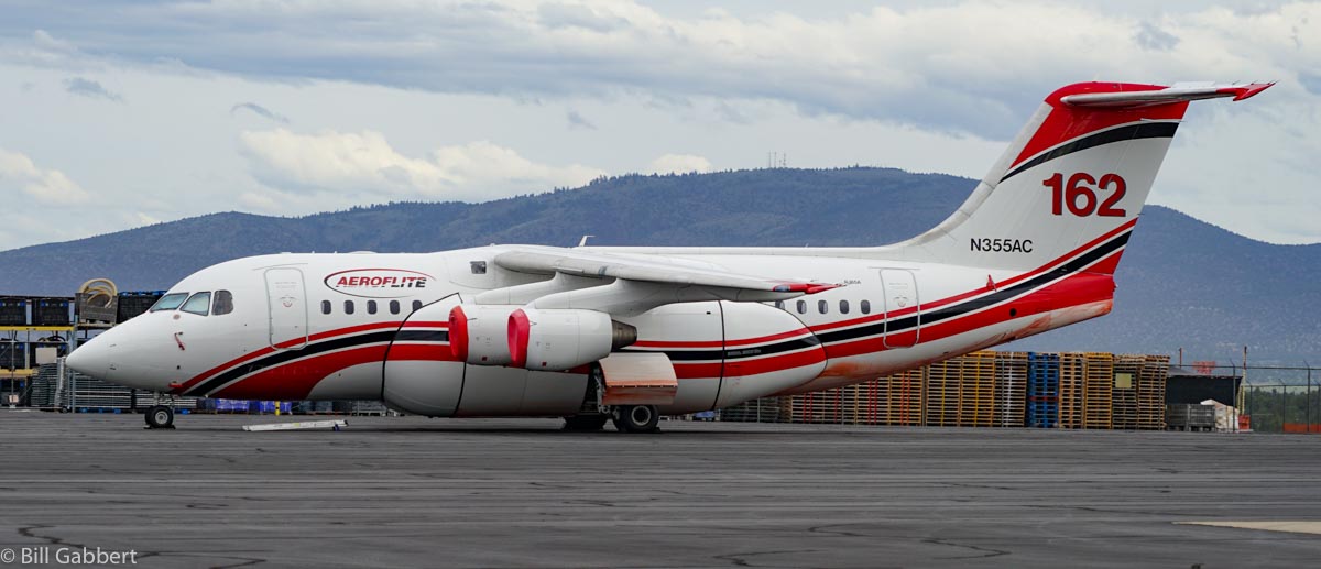
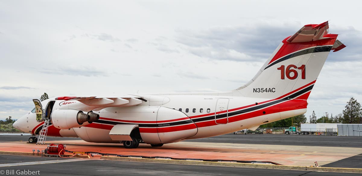
Also at the base was the normal contingent of pilots and mechanics for the four tankers that were on the ramp — three Aeroflite RJ85s, and one Neptune Aviation P2V. One lead plane was also on scene.
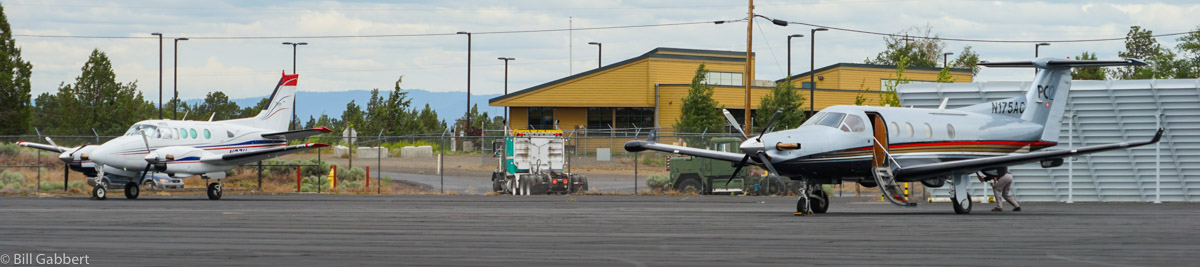
Aeroflite’s Pilatus PC12 (right) and a lead plane (left) at Redmond, Oregon. Photo by Bill Gabbert.
I asked Mr. Graff if dispatchers proactively tried to group aircraft from the same company together at a tanker base, and he said no, it was not intentional. Aeroflite recognized that they had three of their tankers and crews at Redmond and called a meeting, with executives flying in on the company’s Pilatus PC12. The state of Colorado recently purchased two PC12s to use as intelligence gathering and communications platforms, calling them “multi-mission aircraft”.
Other fire-related operations at the Redmond Airport include the Redmond Smokejumpers, the Northwest Fire Training Center, the Redmond Hotshots, and the Regional Air Group which supplies pilots for the jumpers and lead planes.
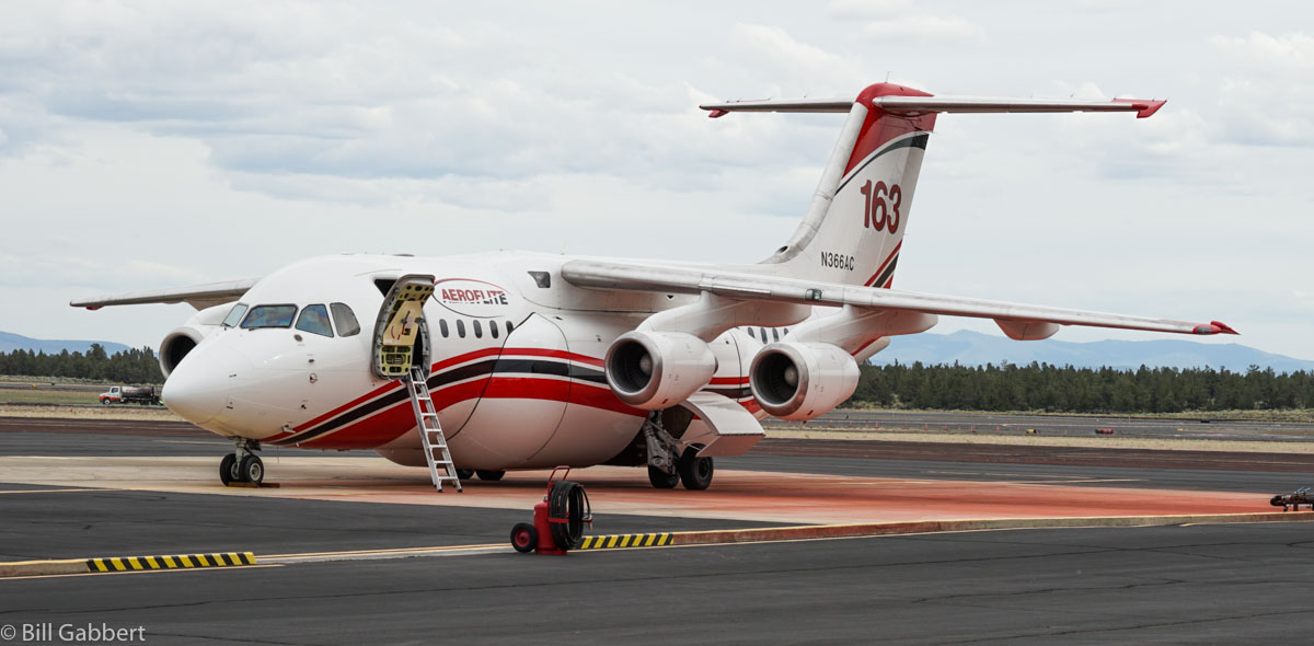
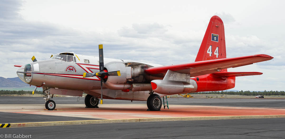
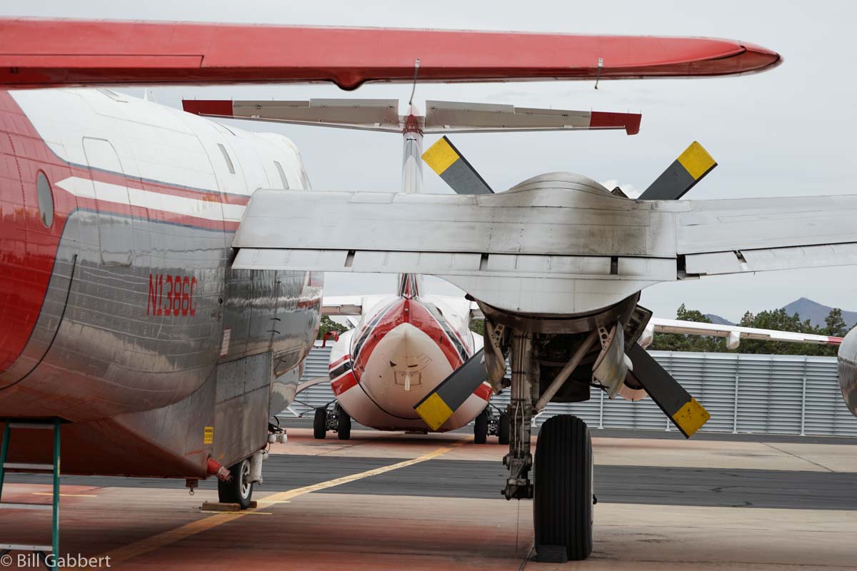
Tanker 163 at Redmond, June 13, 2016. Photo by Bill Gabbert.Tanker 44 at Redmond, June 13, 2016. Photo by Bill Gabbert.Tanker 162 at Redmond, June 13, 2016. Photo by Bill Gabbert.Tanker 161 at Redmond, June 13, 2016. Photo by Bill Gabbert.Tanker 44, in the foreground, and Tanker 161 at Redmond, June 13, 2016. Photo by Bill Gabbert.
Above: One of Colorado’s two Pilatus PC-12 “Multi-mission Aircraft” at McClellan Air Field, March 23, 2016. Photo by Bill Gabbert.
This article was originally published on Wildfire Today.
Colorado’s Center of Excellence for Advanced Technology Aerial Firefighting is requesting information from vendors who could supply equipment that would transmit from aircraft near real-time information about wildfires directly to firefighters on the ground.
The state’s Division of Fire Prevention and Control recently acquired two Pilatus PC-12 Multi-Mission Aircraft. Sensors on the planes can detect and map the location of fires and transmit near real-time spatial data, still images, and short video clips to the Colorado Wildfire Information Management System (CO-WIMS), a web-based situational awareness platform. Fire managers can log into CO-WIMS to view fire perimeters and the other data generated by the aircraft. Firefighters on the ground who have access to the system can view the information as long as they have a good 4G cellular connection. However, many remote areas do not have cellular service.
Colorado’s Request for Information is asking for descriptions and prices of systems that could get this data directly into the hands of firefighters actively engaged in suppressing a fire. Responses are due by June 13, 2016.
This could supply half of the Holy Grail of Wildland Firefighter Safety, providing to firefighters near real-time information about the location of a fire. The other half is near real-time information about the location of firefighters.
Guy Jones, one of the pilots for Colorado’s Pilatus PC-12 “Multi-mission Aircraft”, explains the sensing capabilities of the aircraft’s equipment at McClellan Air Field, March 23, 2016. Photo by Bill Gabbert.
Colorado has two Pilatus PC-12 intelligence gathering aircraft.
We ran across this post today from the Colorado Division of Fire Prevention and Control about their Pilatus PC-12 single-engine aircraft. They have sensors on board that when combined with communications and software capabilities provide wildfire intelligence to office-bound fire managers as well as firefighters on the ground.
Click on the photos to see larger versions.
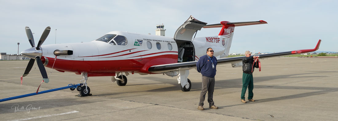
Colorado MMA 327 visited Rifle today; this flight was mostly training/proficiency for pilots and MSO’s. The MMA’s have had a few missions lately.