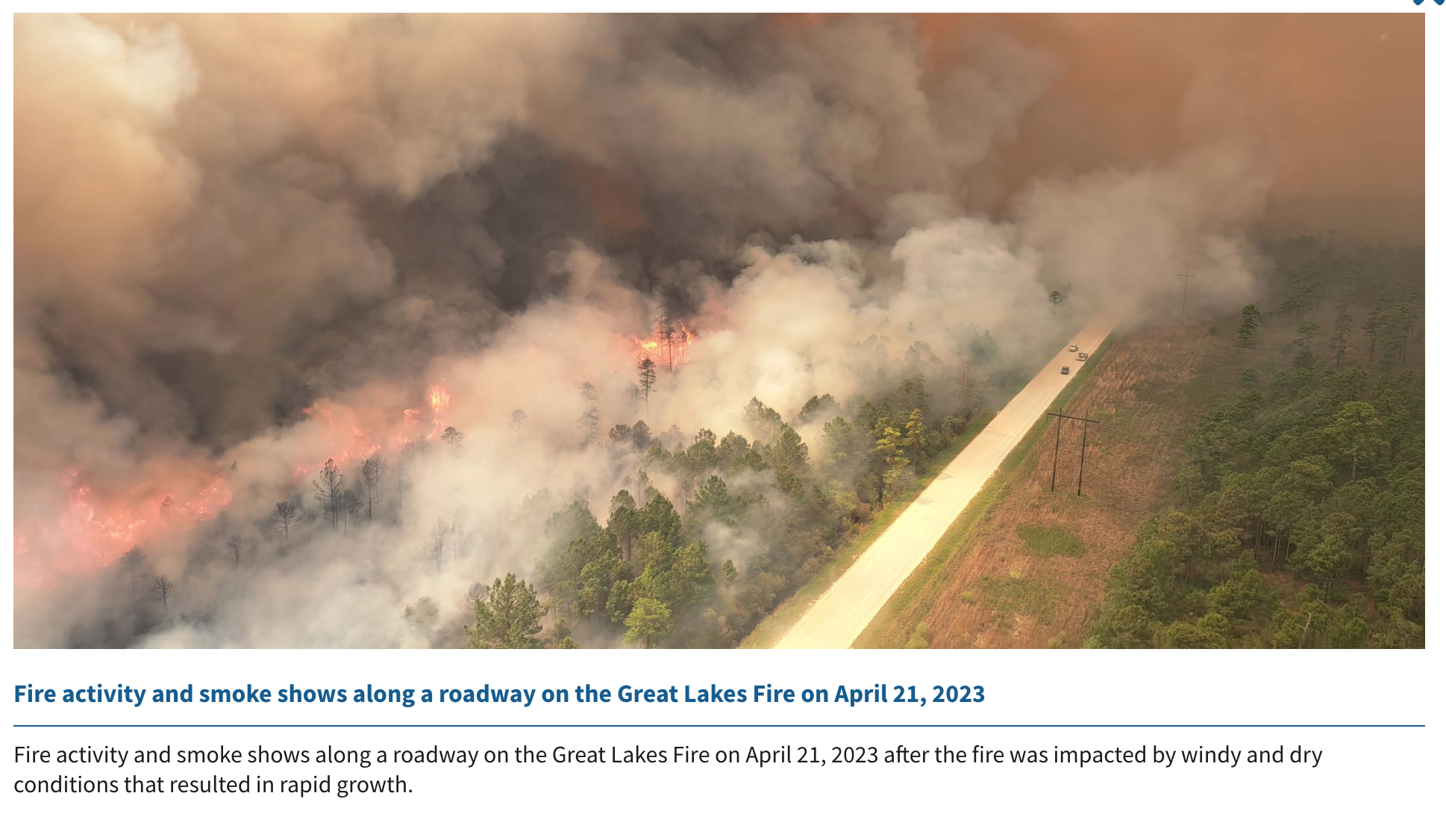
Managing fires is a traditionally on-the-ground profession that adapted quickly to the value of aerial resources. On the Great Lakes Fire in North Carolina, listed at 7000 acres yesterday, a range of sky-based tools help convey the current status, even from a continent away.
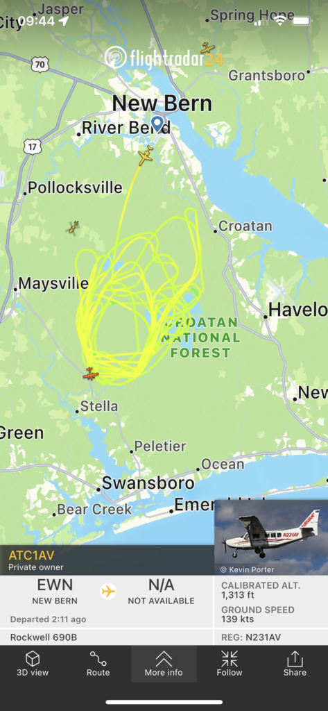
For one, there’s avionics tracking — such as that provided by FlightRadar24. A screen shot just past noon conveys a circle significantly larger than the fire footprint reported the night before.
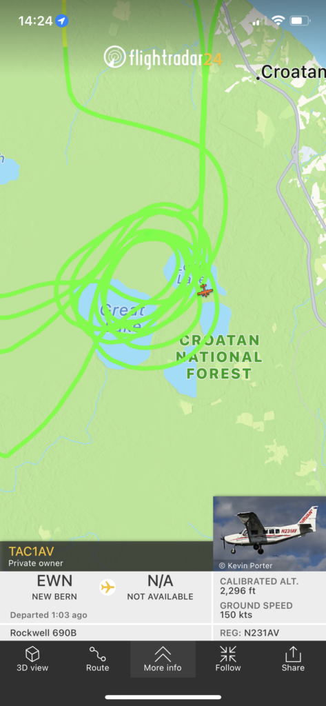
Some seven hours later in the shift, at 1724 EDT, the aerial observation ship is circling tighter and to the north.
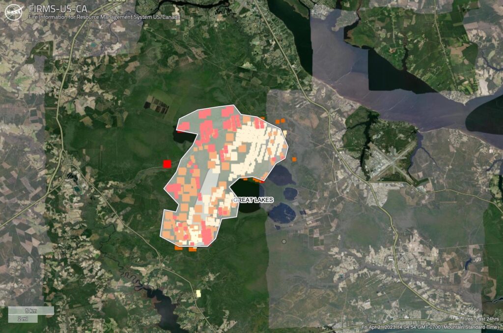
Switching to VIIRS satellites, the heat signature shows growth (and likely burnouts) in the past six hours (the brighter red, with the lighter yellow being 24 hours old). Using the Area tool built into NASA Lance FIRMS site, a rough (and likely large) estimate puts the fire at 30,000 acres.
Switch to the toolset shared via the Risk Management Assistance Dashboard and one can overlay fire histories (the black solid line) … and lo and behold, the current estimated perimeter seems to align with the Dad Fire, a 21,000-acre fire in 2012, as well as prior fuel treatments to the north and south.
![]()
One additional tool is the mapping, forecasting, interpretation, and messaging of smoke and its impacts … as shared here via a Twitter post from the N.C. Air Quality Forecast Center.
URGENT (4:42PM FRIDAY 4/21/2023): UNHEALTHY TO HAZARDOUS AIR QUALITY LIKELY OVER EASTERN NORTH CAROLINA THROUGH TOMORROW OWING TO SMOKE FROM GREAT LAKES FIRE. #ncwx #airquality #AQI
This a developing situation, please see our forecast discussion: https://t.co/A4ceI2rdBO pic.twitter.com/CY1GU9PkfT
— NC Air Quality Forecast Center (@NCDAQ_Forecast) April 21, 2023
We echo what the Air Quality center notes in its tweet: this is a developing situation, and the maps shared here are interpretations of what is certainly more challenging, and being more accurately portrayed, on the ground and in the air above the Croatan National Forest.
04/28 UPDATE: The Great Lakes Fire remains at 32,400 acres with 30 percent containment, according to Inciweb updates. They got a little rain this morning and more is forecast over the weekend. At this morning’s firefighter briefing, meteorologist Scott Kennedy said, “I’m disappointed by the amount of rain over the fire,” referring to last night’s precipitation of approximately ¼ inch of precipitation — or less. We need a lot more rain to saturate the fire that is burning underground.” The fire is suspected to be human-caused and is still under investigation. It’s burning in pocosin swamp and mixed fuels within and around the footprint of the 2012 Dad Fire, which burned roughly 21,331 acres. Previous prescribed burning by the U. S. Forest Service helped slow fire spread this week by reducing the amount of burnable vegetation.