
News 13 out of Asheville recently got up close and personal with a piece of firefighting technology when a news crew joined a North Carolina Forest Service drone pilot on a grid mission to map hotspots. Firefighters are tracking daily progress in heat reduction across the 434-acre Poplar Drive Fire. It is now about 45 percent contained.
“We can give the guys in the field a list or a map; we have tablets that we put the dots on and they can walk right to the dot and see it’s a stump hole or something and they can put water on it,” said Matthew Bishop, a drone pilot based out of New Bern. He explained that the drone flies overnight and shoots infrared photos that feed to a computer program that produces location data.
“We used to call it gridding by hand, and you would literally use the back of your hand,” Bishop said. “This makes it a little easier on everybody.”
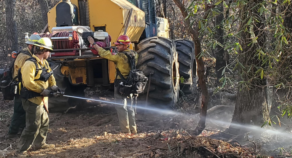
The grid mission was mapping the area where Green Mountain Road meets Kyles Creek Road. Bishop said there could be thousands of hotspots the drone sees that may not be visible to firefighters on the ground, but they can check them the next morning. “We all can see smoke with the helicopters or the regular camera,” said Bishop, “but it’s hard detecting the heat without the thermal imagery.”
Drones can fly in most weather and are water-resistant; they’re equipped with a wide-angle camera, a camera with 200x zoom, and a thermal imaging camera, along with a laser rangefinder to pinpoint precise locations.
News 13 also reported that temporary flight restrictions (TFRs) were established over the fire to keep the public from interfering with firefighting operations.
“On this fire, we’ve got one helicopter that’s providing drops,” North Carolina Forest Service Public Information Officer Philip Jackson said. “We have a scout plane looking for hotspots. If there’s other drones in the area, it might make us ground our own pilots for safety concerns.” Persons violating the TFR are subject to hundreds of dollars in fines.
The TFR up to 7,500 feet was established by state forest officials last Wednesday.
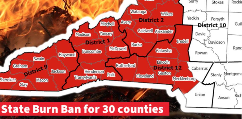
Two state burn bans in 30 western North Carolina counties: Last week, because of increased fire risk, the N.C. Forest Service issued a ban on all open burning and also canceled previous burning permits for many counties until further notice.
“With the long-range forecast and conditions on the ground showing no improvement, expanding the ban on open burning to additional counties is a necessary precaution,” said Agriculture Commissioner Steve Troxler. “We keep a close eye on weather, fire danger, and fuel conditions, especially this time of year. We’re making daily assessments, and the burn ban will be expanded into Piedmont counties and farther east if needed. If you’re in a county that does not fall under the ban, think twice about any outdoor burning until we see significant soaking rain across the state.” He said anyone violating the burn ban faces a $100 fine plus $183 in court costs, and anyone setting a fire may also be liable for the costs of suppressing the fire.
Details on burn bans are online [HERE].
Jackson cautioned against violating the burn ban or the flight restrictions prohibiting flying a drone over or near the Poplar Drive Fire.
“Drones can and have collided with aircrafts before,” Jackson said. “It’s a real safety hazard for the pilots and significantly impedes our ability to do our job.”